(a) (i) Draw an annotated cross profile from point A to point B.
(ii) Are points A and B intervisible? (Give one reason for your answer)
(b) In what three ways has the relief affected the transportation network of the mapped area?
(c) Give any two reasons why the area mapped is sparcely populated.
(ii) Are points A and B intervisible? (Give one reason for your answer)
(b) In what three ways has the relief affected the transportation network of the mapped area?
(c) Give any two reasons why the area mapped is sparcely populated.
Take Free Practice Test On 2026 JAMB UTME, Post UTME, WAEC SSCE, GCE, NECO SSCE
Correct Answer: Option n
Explanation:
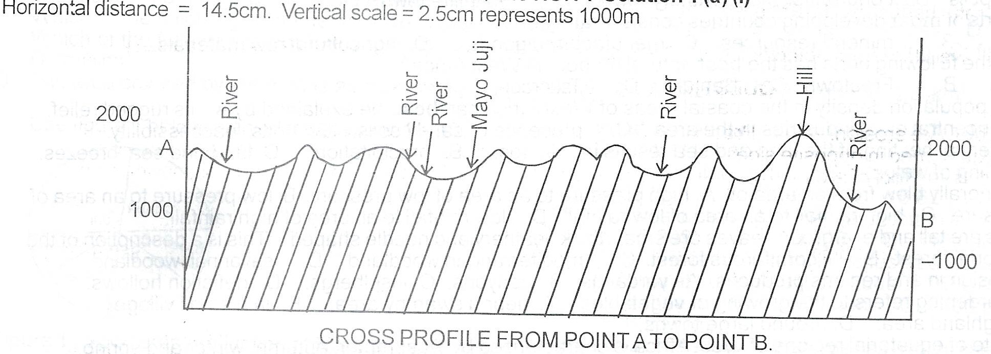
SOLUTION 1 (a) (ii)
Point A is not visible from B. This is because there are hills in-between them that obstruct visibility
SOLUTION 1 (B);
The whole area is an upland, making it difficult to construct roads. West and North of the map have rugged hills hence no transportation line exist. The eastern part is less rugged and therefore a secondary road runs across the south east. Footpaths are few and far apart because of high relief.
SOLUTION 1 (C)
The Western and Northern parts have rugged relief hence there Pre no settlements in the area. The, Eastern part too, is less rugged and has undulating upland hence there are very few scattered settlements. The whole area is high and inaccessible hence there are few settlements in the area. The area is sparsely settled because farming cannot be easily practised.